Drone Magnetic Survey Uganda

Rapid, high-resolution airborne magnetics with the AeroSmartMag Overhauser sensor on a DJI M300 RTK — the first of its kind operated by a Ugandan company. Map mineral targets and geological structures across thousands of hectares in days, not weeks.

Request a Quote View Related Projects

What Is a Drone Magnetic Survey?

A drone magnetic survey is an airborne geophysical technique that measures variations in the Earth's magnetic field from an unmanned aerial vehicle (UAV). A highly sensitive Overhauser magnetometer is suspended beneath the drone, which autonomously flies a pre-planned lawnmower grid over the survey area. As the platform moves, the sensor records the total magnetic field at regular intervals, producing a dense dataset that is processed into a continuous magnetic anomaly map.

Because different rock types contain varying amounts of magnetic minerals (primarily magnetite), the method reveals subsurface geology without any ground disturbance. A drone magnetic survey in Uganda is particularly powerful for mineral exploration, where it maps the structural framework controlling gold, tin, coltan, and rare-element pegmatite mineralisation. It also supports geological mapping, archaeology, and unexploded ordnance (UXO) detection.

Georesolve Africa is the first Ugandan company to operate an airborne magnetic sensor. By pairing the AeroSmartMag Overhauser drone magnetometer with the DJI M300 RTK airframe, we deliver drone magnetic surveys across Uganda, Rwanda, Burundi, and the wider East African region — covering terrain that would be impractical or unsafe for ground crews, at a fraction of the cost of conventional helicopter-borne surveys.

How a Drone Magnetic Survey Works

  1. Flight planning. The survey area is defined in G-FlightPlanner or similar mission software. Line spacing is set based on target size (typically 50–200 m), with tie lines perpendicular to the main grid for levelling. The drone's flight altitude is set to maintain a safe ground clearance while keeping the sensor close enough to preserve near-surface resolution.
  2. Base station setup. A magnetic base station is established at a fixed, magnetically quiet location outside the survey area. It records the diurnal variation of the Earth's field throughout the survey so that temporal drift can be removed during processing.
  3. Data acquisition. The DJI M300 RTK flies the pre-planned grid autonomously while the AeroSmartMag sensor logs total-field magnetic data at high sample rates. The built-in multi-band GNSS and external helical antenna record the sensor's position with centimetre-level RTK accuracy.
  4. Diurnal correction & levelling. The base-station record is subtracted from the airborne data to remove diurnal variation. Micro-levelling algorithms remove residual line-to-line shifts, producing a clean total magnetic intensity (TMI) grid.
  5. Filtering & enhancement. The TMI grid is processed to derive the residual magnetic field, analytic signal, first vertical derivative, and tilt-derivative products. These enhancements sharpen anomaly edges and highlight shallow sources.
  6. Interpretation & reporting. Anomalies are interpreted in the geological context of the project. Structural lineaments are mapped, targets are prioritised, and a technical report with GIS-ready layers is delivered to the client.

Equipment

Georesolve operates the AeroSmartMag Overhauser drone magnetometer, a purpose-built airborne magnetic system, mounted on the DJI Matrice 300 RTK (M300 RTK) unmanned aircraft.

Component Specification
Sensor AeroSmartMag portable Overhauser (OVH) magnetometer with horizontal and vertical orientation clamps on a carbon frame
Console AeroSmartMag console with built-in multi-band GNSS for timing and positioning
GNSS antenna External helical multi-band GNSS antenna with SMA connector for centimetre-level RTK positioning
Suspension ASM suspension rope for stable sensor flight and vibration dampening
Connectivity USB and USB-C cables for data download and system configuration
Transport Padded transportation case for field deployment across East Africa
Airframe DJI Matrice 300 RTK (M300 RTK) — industrial-grade UAV with 55-minute flight endurance, RTK positioning, and all-weather capability
Sensor type Overhauser effect — high sensitivity, low power consumption, no heading error

For ground-based follow-up on identified anomalies, Georesolve also operates the GSM 19 Overhauser walking magnetometer with built-in GPS, enabling detailed traverses at higher spatial resolution.

Applications

Mineral Exploration

Target generation for gold, cassiterite, coltan, pegmatite-hosted Li-Sn-Ta, and iron ore across Uganda and East Africa.

Geological Mapping

Rapid mapping of lithological contacts, dykes, and intrusive bodies over large areas with no ground access required.

Structural Interpretation

Delineation of faults, shear zones, and structural corridors that control fluid flow and mineralisation.

UXO Detection

Safe, rapid detection of unexploded ordnance and buried metallic objects on construction or brownfield sites.

Archaeological Surveys

Non-invasive mapping of buried structures, hearths, and ferrous features at archaeological sites.

Groundwater & Engineering

Mapping of dyke-bound aquifer compartments and depth-to-magnetic basement for civil engineering projects.

Deliverables

Every drone magnetic survey is delivered as a complete, ready-to-interpret data package:

Case Study: Magnetic Survey for Pegmatite Exploration, Rweru Sector, Rwanda
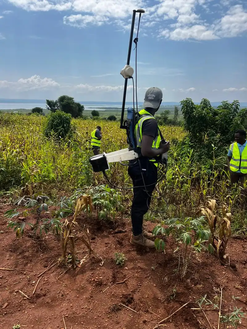
Ground magnetic survey for pegmatite exploration in Rweru, Rwanda

Integrated Geophysical Survey for Pegmatite Exploration — Rweru Sector

Location: Rweru Sector, Rwanda Year: 2026 Client: Confidential mining client

Georesolve delivered an integrated mineral exploration programme combining ground magnetics, deep Electrical Resistivity Tomography (ERT), and Induced Polarisation (IP) surveys for pegmatite-hosted cassiterite, coltan, and cobalt mineralisation in the Rweru Sector.

The magnetic component mapped the structural framework and delineated subsurface magnetic bodies associated with the pegmatite swarm. Anomalies identified from the magnetic data guided the placement of ERT and IP profiles, which in turn imaged the pegmatite bodies in detail and defined drill targets for follow-up exploration.


View this and other projects in our portfolio →

Frequently Asked Questions

What is a drone magnetic survey?

A drone magnetic survey is an airborne geophysical method that measures the Earth's magnetic field from an unmanned aerial vehicle (UAV). A magnetometer sensor is suspended beneath the drone, which flies in a lawnmower grid pattern over the survey area. The result is a high-resolution magnetic anomaly map used to detect mineral deposits, geological structures, and buried magnetic bodies without any ground disturbance.

How fast can a drone magnetic survey cover ground in Uganda?

A drone magnetic survey can cover 5 to 15 square kilometres per field day depending on line spacing, terrain, and wind conditions. This is significantly faster than walking ground magnetics, making it ideal for regional reconnaissance and first-pass target generation across large exploration licenses in Uganda and the wider East African region.

What equipment does Georesolve use for drone magnetics?

Georesolve uses the AeroSmartMag Overhauser drone magnetometer mounted on a DJI M300 RTK platform. The system includes a console with built-in multi-band GNSS, a portable Overhauser sensor with horizontal and vertical orientation clamps on a carbon frame, an external helical multi-band GNSS antenna, an ASM suspension rope, and USB/USB-C connectivity. Georesolve is the first Ugandan company to operate this airborne magnetic sensor.

What is the difference between drone magnetics and ground magnetics?

Drone magnetics flies the sensor above the ground in a controlled grid, enabling rapid coverage of large areas and access to terrain that is difficult or unsafe to walk. Ground magnetics uses a walking magnetometer (such as the GSM 19 Overhauser) and delivers higher near-surface resolution along traverses. The two methods are complementary: drone magnetics for regional mapping and target generation, ground magnetics for detailed follow-up on identified anomalies.

What deliverables do I receive from a drone magnetic survey?

You receive a total magnetic field anomaly map, a residual magnetic field grid, 2D and 3D inversions where requested, an interpreted structural lineament map, GIS-ready XYZ and GeoTIFF data layers, and a comprehensive technical report. All data is delivered in formats compatible with QGIS, ArcGIS, and major geophysical interpretation software.

Can a drone magnetic survey detect gold or mineral deposits in Uganda?

Drone magnetics does not detect gold directly, but it maps the magnetic minerals and geological structures that host mineralisation. Magnetic surveys are highly effective for delineating banded iron formations, mafic and ultramafic bodies, shear zones, and structural traps that control gold, cassiterite, coltan, and other mineral deposits. The method is a proven first step in any exploration programme in Uganda and East Africa.

Related Services

Ready to Map Your Project From the Air?

Talk to Georesolve Africa about a drone magnetic survey for your exploration license, geological mapping programme, or structural study in Uganda and East Africa.

Request a Quote

Trusted by Leading Organizations

GeoResolve partners with government agencies, consulting firms, and private sector clients across East Africa