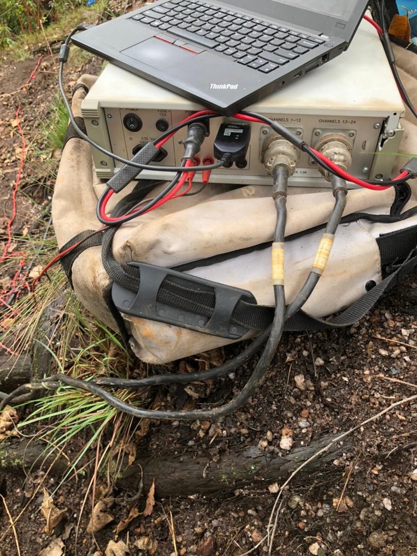
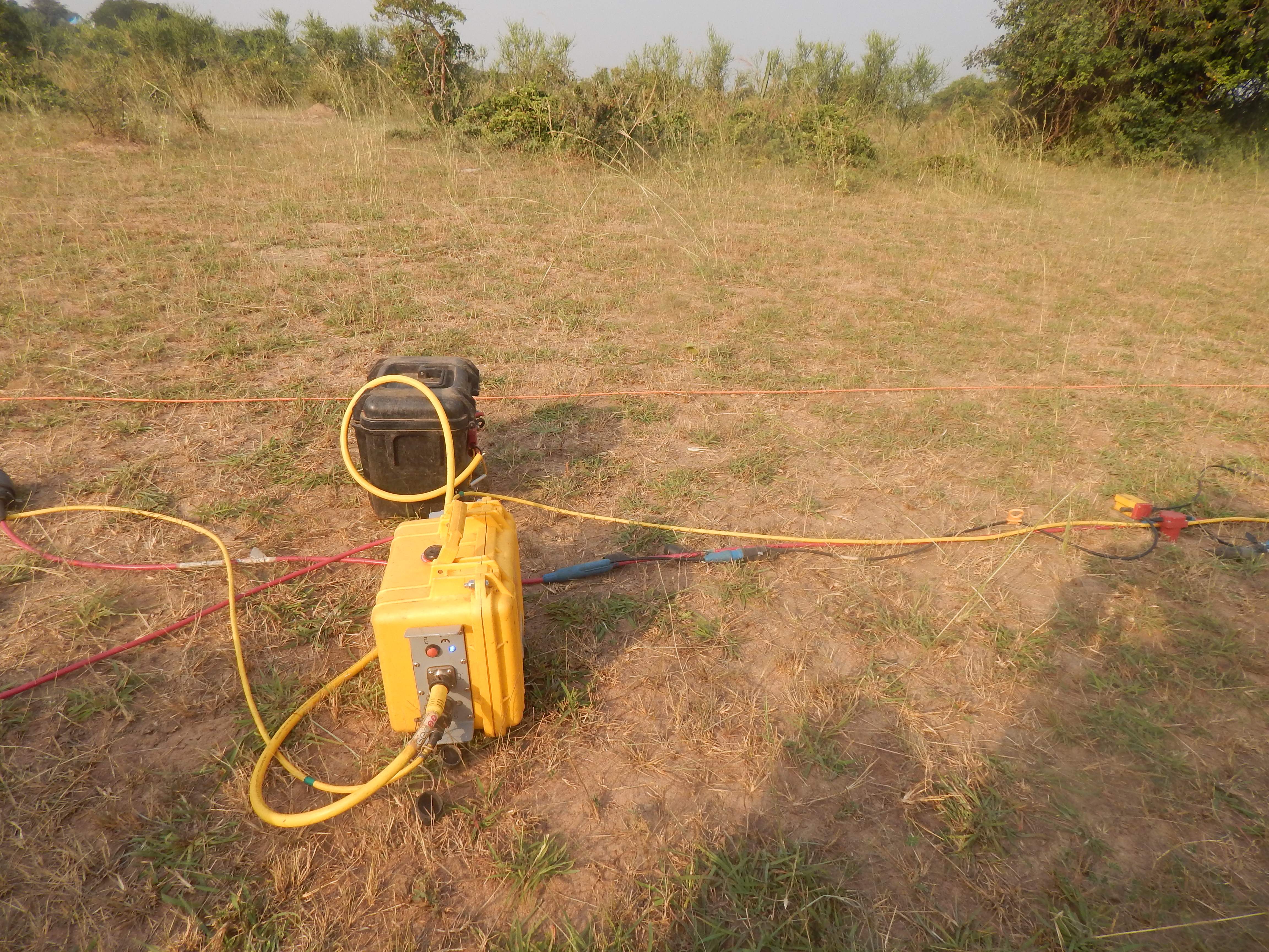
| Seismic Refraction |
3-100 m |
|
|
1.5 km/day |
Bedrock depth & rippability, Dam foundation investigation, Stratigraphic mapping |
2D P-wave velocity profileDepth-to-bedrock contour mapRippability / excavatability assessment |
Cannot detect velocity inversions (a low-velocity layer masked beneath a faster layer is invisible) Requires good ground coupling and a spread of geophones (50-200 m layout) Cultural vibration (traffic, machinery) degrades first-arrival picks |
| MASW (Multi-channel Analysis of Surface Waves) |
1-50 m |
|
|
2 km/day |
Vs30 / site class (IBC/ASCE), Dam foundation investigation, Liquefaction screening |
1D/2D shear-wave velocity (Vs) profileVs30 site classification per IBC/ASCELiquefaction susceptibility map |
Maximum reliable depth ~30-50 m with active-source MASW Resolution drops sharply below 1/3 of maximum depth Passive MASW extends depth but lowers near-surface resolution |
| Electrical Resistivity Tomography (2D ERT) |
1-1000 m |
|
|
1.2 km/day |
Groundwater mapping, Contamination / leachate plumes, Cavity detection in resistive rock |
2D resistivity cross-section (inverted model)Depth to water table / aquifer geometryContaminant plume delineation |
Requires good electrode-to-ground contact (difficult on dry gravel, hardpan, or paved surfaces) Conductive clay overburden suppresses signal from deeper resistive targets Deep investigations need long layouts (depth ~1/6 of array length) |
| Vertical Electrical Sounding (VES) |
5-500 m |
|
|
5 km/day |
Borehole siting (point depth), Groundwater exploration at limited-access sites, Layer resistivity at a point |
1D layer resistivity model at each soundingRecommended drilling depth for boreholesAquifer resistivity / yield correlation |
1D point measurement — no lateral continuity between soundings unless densely spaced Layer equivalence: multiple layer models can fit the same curve Conductive overburden limits depth of investigation |
| Ground Penetrating Radar (GPR) |
0.1-30 m |
|
|
5 km/day |
Utility & pipe mapping, Concrete/bridge deck inspection, Shallow stratigraphy & archaeology |
High-resolution 2D/3D radar profileMapped utility/pipe positions & depthsConcrete cover and rebar mapping |
Signal is strongly attenuated in conductive (clayey, saline, waterlogged) soils — penetration may fall to <1 m Maximum reliable depth typically 15-30 m in resistive ground; far less in clay Antenna frequency trades depth for resolution (low freq = deep but coarse) |
| Magnetic Survey |
1-300 m |
|
|
8 km/day |
Mineral exploration (iron, massive sulphides), Structural / dyke mapping, Buried metal & UXO detection |
Magnetic anomaly map (total field / residual)Structural interpretation lineamentsTarget anomalies for follow-up drilling |
Strongly affected by cultural metal (fences, pipelines, reinforced concrete) in urban/industrial areas Non-unique: many source bodies can produce the same anomaly Depth estimation from magnetics alone is approximate without modelling |
| Gravity Survey |
10-5000 m |
|
|
3 km/day |
Basement / sedimentary basin geometry, Cavity & void detection (microgravity), Ore-body delineation (dense ore) |
Bouguer / residual gravity anomaly map2D/2.75D density models along profilesCavity probability map (microgravity) |
Requires very precise station levelling and terrain corrections — slow to acquire and process Small targets need dense station spacing and excellent elevation control Near-surface density variations can mask deeper targets |
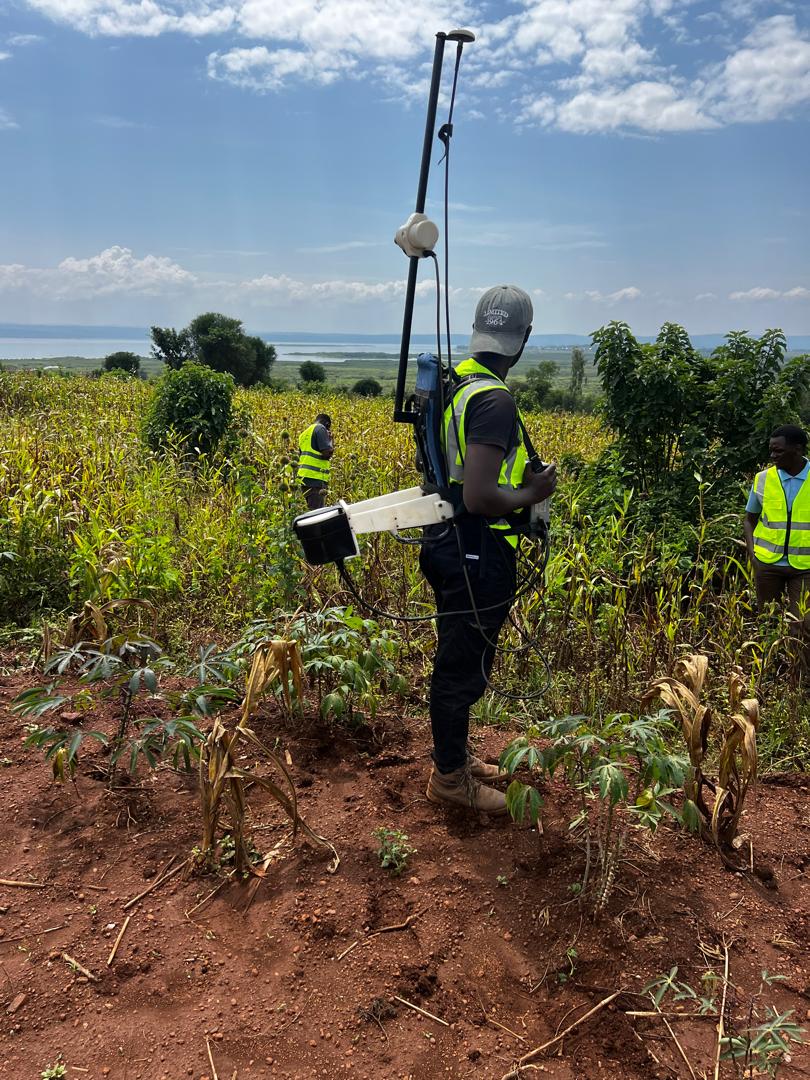
| Electromagnetic (FDEM) |
0.5-50 m |
|
|
10 km/day |
Groundwater / salinity mapping, Contaminant / leachate plumes, Shallow ore & conductivity mapping |
Apparent conductivity / in-phase map2D conductivity cross-sectionSalinity / contaminant plume delineation |
Conductive overburden (clay/saline) limits depth of investigation for resistive targets below Sensitive to cultural metal and power-line interference in urban/industrial areas Frequency / coil spacing trades depth for resolution; deep targets (>50 m) need low-frequency TDEM instead |
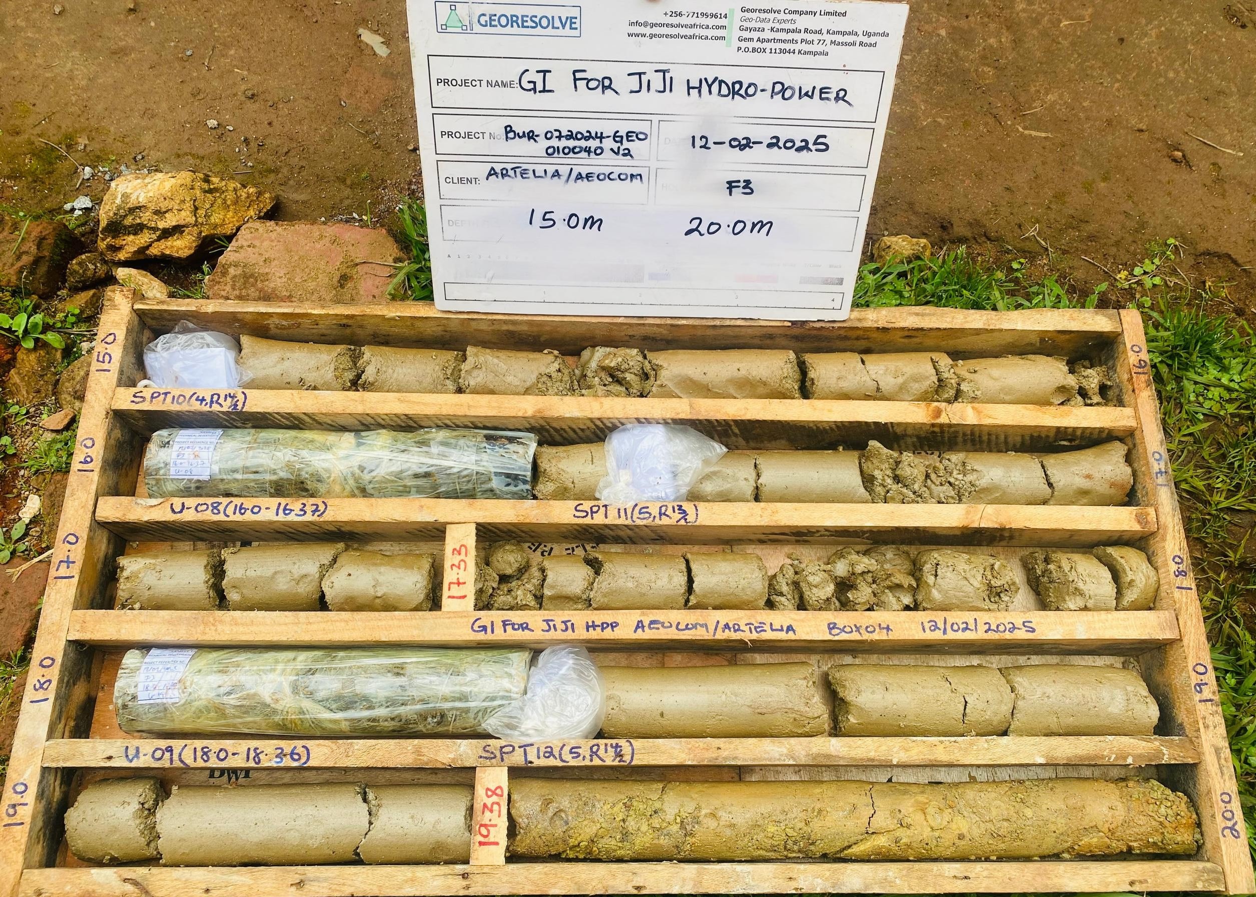
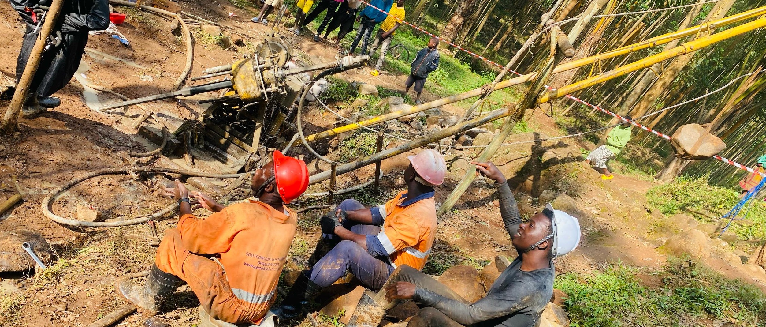
| Geotechnical Drilling (ground truth) |
1-200 m |
|
|
0.3 km/day |
Ground-truth calibration for geophysics, SPT & UDS sampling for design parameters, Borehole lithology |
Borehole logs (lithology, SPT, recovery, RQD)Index & engineering properties from lab testingGeotechnical design parameters (bearing capacity, settlement) |
Point data only — interpolation between boreholes is uncertain without geophysics High cost per metre and slow mobilisation; access can be difficult on steep or soft ground Holes must be backfilled / sealed; environmental permitting may apply |