MASW Survey Uganda

Multichannel Analysis of Surface Waves (MASW) for fast, non-invasive shear-wave velocity profiling. Determine Vs30, seismic site class, and dynamic soil properties for dams, railways, bridges, and buildings across East Africa — without drilling a single borehole.

Request a Quote View Related Projects

What Is an MASW Survey?

An MASW survey is a seismic method that uses surface waves to measure the shear-wave velocity (Vs) of the ground as a function of depth. A line of geophones records the ground vibration produced by a surface impact (such as a sledgehammer blow). Because surface (Rayleigh) waves travel at different speeds depending on frequency, their dispersion is inverted into a continuous Vs-depth profile — the single property engineers need most for stiffness and seismic design.

An MASW survey in Uganda is the fastest, most cost-effective way to assign a seismic site class to a project area. Unlike boreholes, which sample only a point, MASW integrates stiffness over a lateral window, giving a robust, spatially representative Vs30 value. This makes it ideal for the repetitive site characterisation demanded by long linear infrastructure such as railways and irrigation schemes.

Georesolve Africa operates MASW surveys across Uganda, Rwanda, Burundi, and the wider East African region, often combined with seismic refraction so that bedrock depth (P-wave) and dynamic stiffness (S-wave) are characterised together in a single mobilisation.

How an MASW Survey Works

  1. Array layout. A line of 24–48 geophones is laid out at a fixed interval (typically 0.5–2 m) along the survey profile. The spread length sets the maximum investigation depth.
  2. Source activation. A surface impact — a sledgehammer on a plate or a weight drop — generates Rayleigh surface waves. Several blows are stacked to improve the signal-to-noise ratio.
  3. Wavefield recording. The multichannel seismograph records the full shot gather. The surface wave appears as a dispersive, frequency-dependent arrival across the geophone array.
  4. Dispersion analysis. A multichannel analysis (fk or phase-shift transform) extracts the dispersion curve — phase velocity versus frequency — for each MASW record.
  5. Inversion. The dispersion curve is inverted into a 1D shear-wave velocity (Vs) model with depth. Multiple lines are merged into a 2D Vs cross-section.
  6. Classification & reporting. The Vs profile is reduced to a Vs30 value and seismic site class, then delivered in a technical report with interpretation for foundation and seismic design.

Equipment

Georesolve operates a multichannel surface-wave acquisition system optimised for rapid Vs profiling on infrastructure projects.

Component Specification
Seismograph Multi-channel digital engineering seismograph with GPS timing for accurate surface-wave recording
Geophone array 24–48 vertical geophones at 4.5 Hz (or higher) laid out at a configurable interval
Source Sledgehammer with strike plate and/or weight-drop system for repeatable surface impacts
Spread length Configurable (typically 12–96 m) to target investigation depths of 20–40 m+
Measured parameter Rayleigh-wave phase velocity versus frequency (dispersion)
Derived products Shear-wave velocity (Vs) with depth, Vs30, seismic site class, shear modulus

For depth-controlled, borehole-based measurements, Georesolve also operates downhole and crosshole seismic surveys, which provide an independent check on the MASW shear-wave model.

Applications

Seismic Site Classification

Vs30 and site-class determination for structures in seismic or volcanic-risk zones across East Africa.

Dam & Embankment Design

Stiffness profiling of foundation and core zones to support seepage and deformation analysis.

Railway & Road Corridors

Fast, repetitive Vs profiling along long alignments for earthwork and foundation design.

Bridge & Building Foundations

Dynamic soil properties for foundation springs, settlement, and lateral load response.

Hospital & Critical Facilities

Site-class verification for healthcare and emergency infrastructure where resilience matters.

Ground-Motion Modelling

Depth-dependent Vs models for site amplification and ground-response analyses.

Deliverables

Every MASW survey is delivered as a complete, interpretation-ready data package:

Case Study: MASW for Hospital Extension Site Classification, Kigali, Rwanda
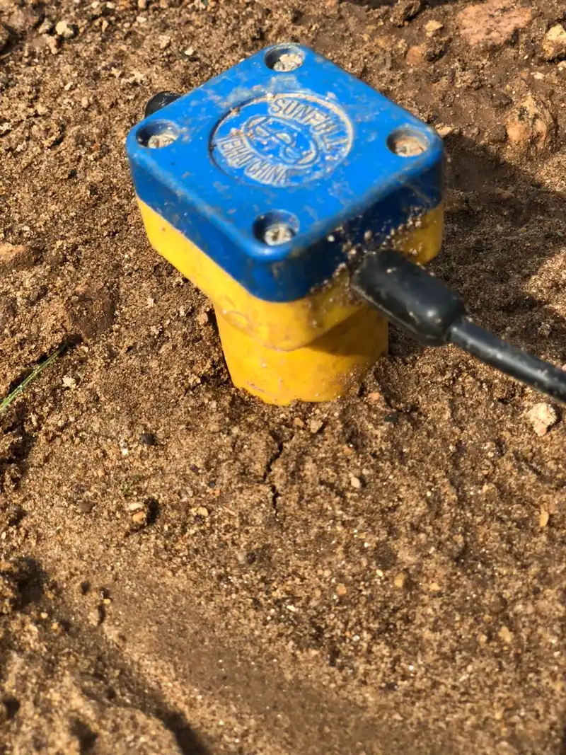
MASW shear-wave velocity survey for a hospital extension in Kigali, Rwanda

MASW Survey for the King Faisal Hospital Extension — Kigali

Location: Kigali, Rwanda Year: 2025 Client: Confidential healthcare client

Georesolve carried out a Multichannel Analysis of Surface Waves (MASW) survey for the proposed extension of King Faisal Hospital in Kigali. The objective was subsurface stiffness profiling and seismic site classification to inform foundation design and structural engineering for the critical healthcare infrastructure expansion.

The MASW campaign delivered shear-wave velocity profiles across the extension site, from which a Vs30 value and seismic site class were derived. These parameters were passed directly to the structural engineers, providing the dynamic soil properties needed for foundation design and seismic resilience of the hospital extension.


View this and other projects in our portfolio →

Frequently Asked Questions

What is MASW?

MASW (Multichannel Analysis of Surface Waves) is a seismic method that analyses the velocity of Rayleigh surface waves to build a 1D or 2D profile of shear-wave velocity (Vs) with depth. Geophones laid out in a line record a surface impact, and the dispersive nature of surface waves is inverted into a Vs-depth model. It is fast, non-invasive, and ideal for site characterisation.

What is MASW used for?

MASW is primarily used for seismic site classification (Vs30), dynamic soil property determination, foundation and embankment characterisation, and ground-stiffness mapping. In Uganda and East Africa it supports dams, railways, bridges, hospitals, and high-rise foundations where shear-wave velocity controls seismic design and settlement behaviour.

How is MASW different from seismic refraction?

Seismic refraction measures compressional (P) wave velocities to map bedrock depth and rippability, while MASW measures shear-wave (Vs) velocity, which governs how the ground deforms under load and during an earthquake. The two are complementary: refraction gives stratigraphy and bedrock, MASW gives the stiffness and site class that engineers use directly in design.

How deep can a MASW survey see in Uganda?

Investigation depth depends on the geophone spread length and the lowest surface-wave frequency recorded. With a typical 24 to 48-channel array, MASW reliably profiles shear-wave velocity to 20–40 m, and deeper with longer spreads. That depth range covers most foundation, embankment, and site-classification needs for infrastructure in East Africa.

How long does an MASW survey take?

A single MASW line is acquired in minutes — the source is a sledgehammer or weight drop and no boreholes are required. A site with a few profiles can be completed in a day. This speed makes MASW cost-effective for covering wide corridors such as railways and irrigation schemes, and for dense site grids under buildings.

What deliverables do I receive from a MASW survey?

You receive the dispersion image and picked curves, 1D/2D shear-wave velocity (Vs) profiles with depth, a Vs30 value and seismic site class, and a technical report with interpretation for foundation and seismic design. Data is delivered in formats compatible with geotechnical and GIS software.

Related Services

Need a Fast Vs30 and Site Class?

Talk to Georesolve Africa about an MASW survey for your dam, railway, bridge, hospital, or building foundation in Uganda and East Africa.

Request a Quote

Trusted by Leading Organizations

GeoResolve partners with government agencies, consulting firms, and private sector clients across East Africa