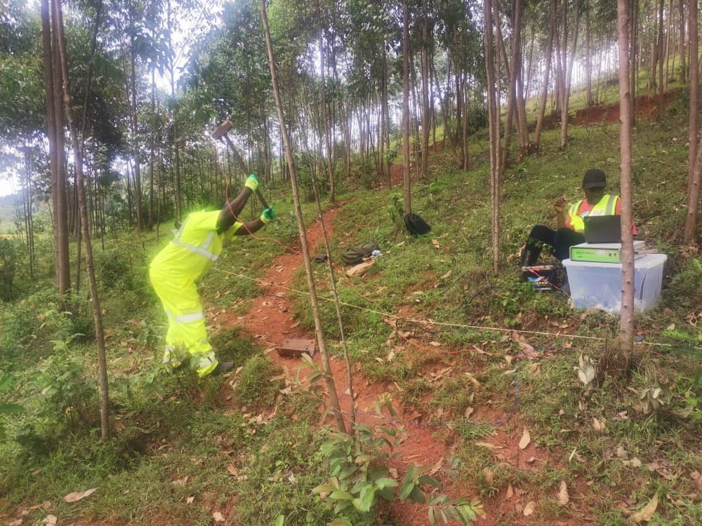
Between October and November 2025, our team completed an integrated geophysical programme across three proposed dam sites on the Mwogo, Rukarara and Kavili rivers in Rwanda's Southern and Western provinces. The client, ZV Consulting Ltd, needed defensible foundation characterisation to support preliminary dam design — before committing to a full geotechnical drilling campaign. This is a short field report on what we did and what it told us.
The investigation objective
For a run-of-river or small RCC dam, the two questions that matter most at feasibility stage are: how deep is competent bedrock, and what is the shear-wave velocity of the overburden and the upper bedrock? The first drives the excavation depth and foundation footprint; the second feeds the seismic site response and liquefaction screening that the structural engineer needs for the dam-body design.
Methods deployed
We ran two complementary seismic methods at each site:
- Seismic refraction — 1,200 m of P-wave profiling using a 24-channel seismograph, 5 m geophone spacing, and a 12 kg sledgehammer source. First-arrival picking and inversion gave us a 2D P-wave velocity model along each proposed dam axis.
- MASW (Multi-channel Analysis of Surface Waves) — 1,200 m of surface-wave acquisition using the same spread, processed to 1D Vs profiles at each geophone array centroid. MASW is the method that gives you Vs30 and the IBC/ASCE site class, which is what the dam engineer's seismic code checks require.
What the data showed
Across the three sites the bedrock surface varied from 4 m to over 18 m depth, controlled by weathering rather than structural offset. The refraction models resolved a clear three-layer structure: a thin, low-Vp topsoil, a weathered saprolite layer with Vp in the 800–1,400 m/s range, and fresh bedrock at Vp > 2,500 m/s. MASW confirmed the same boundaries independently through the Vs profile and gave us Vs30 values that place all three sites in IBC site class C — favourable for dam design, with no liquefaction-prone layers identified in the overburden.
Why the combination matters
Seismic refraction is excellent at the P-wave velocity structure but cannot, by itself, resolve a velocity inversion — a soft layer hidden beneath a stiffer one. MASW, being a surface-wave method, is far less sensitive to that blind spot and provides the shear-wave data the structural code requires. Running both on the same spread is a small incremental cost for a large reduction in interpretive risk, which is why it is our default combination for dam foundations.
Correlation with geotechnical data
The geophysical models are being correlated with a limited number of geotechnical boreholes at each site. That calibration is what turns a velocity model into an engineering parameter — Vp-to-rock-quality, Vs-to-small-strain shear modulus. The result is a continuous 2D foundation model between borehole points, which is the real value proposition of doing the geophysics at all.
FAQ
Q: Why MASW in addition to refraction for a dam site?
A: Refraction gives P-wave structure and depth-to-bedrock but misses velocity inversions and cannot provide the shear-wave velocity that seismic design codes (IBC, ASCE 7) require. MASW fills both gaps.
Q: How much geophysics do you need before drilling?
A: For a small dam, one seismic refraction + MASW line per axis (200–400 m) is typically enough to site the calibration boreholes intelligently. Drilling blind costs more and gives you point data with no continuity between holes.